Climate observation network
Climate is an important driver of ecosystem dynamics and an expression of the mean long-term weather conditions over at least 30 years. Especially in alpine environments, climate is extremely variable in space and time. The national park's research infrastructure makes it possible to analyse climate and its effects over large time spans. For these reasons, the national park operates a dense network of weather stations serving as reference for climate research in high mountain regions.
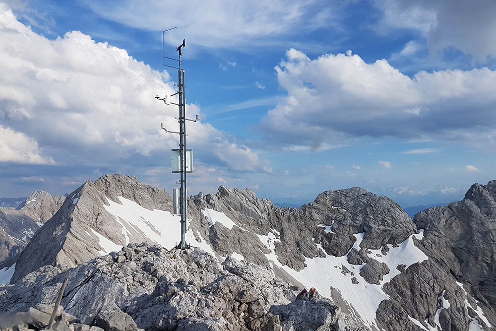
Automatic climate station at Hinterberghorn
Dating back to 2005 the network of fully automated weather stations has been established gradually and in close cooperation with the Bavarian Avalanche Warning Service and the German Meteorological Service. It emerged from a former network of mechanical stations that started operating in the early years of the national park.
Today’s observation network provides high spatial and temporal resolution: it currently comprises 15 stations at altitudes ranging from 800 to 2.700 m a.s.l. and recording in 10 minutes intervals. Data transfer via mobile communication enables almost real time integration into the park’s database. Data immediacy is of great importance for the Bavarian flood and avalanche warning services.
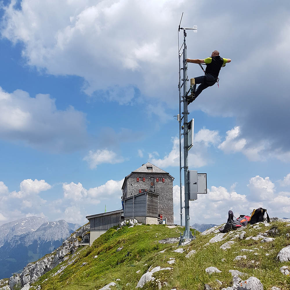
Maintenance of the automatic climate station at Watzmannhaus
Each station is equipped slightly differently. Air temperature and humidity are always recorded, usually wind speed and wind direction as well. Global radiation and reflection provide information about the energy flux. Recording of precipitation occurs only at sites with undisturbed deposition conditions. Snow depth results from ultrasonic signals and in some cases, snow scales additionally determine the weight of the snow pack. The greatest variety of sensors is available at the Kühroint site that is representing a joint infrastructure with the Bavarian Avalanche Warning Service.
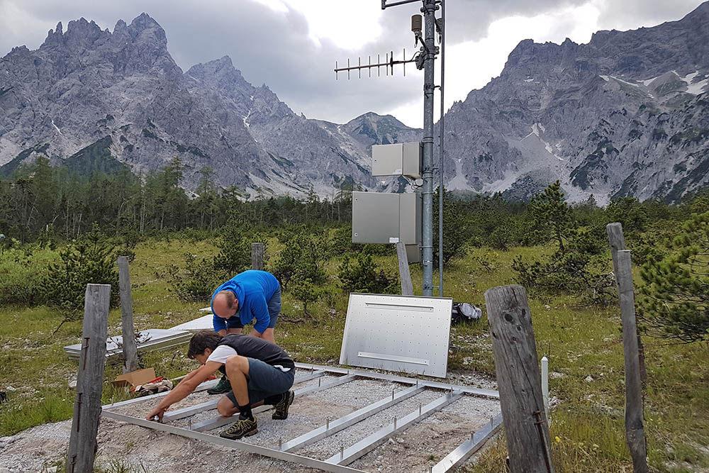
Installation of snow scales at Brunftbergtiefe station
The technical service of the stations concentrates on 1-2 days per year. At extreme sites, the maintenance occurs by helicopter. Potential sensor failures at these sites are deliberately accepted if they should occur beyond the regular service routines. Disregarding occasional gaps, time series are growing continuously with each further record year - even in these remote sites.
The digital weather stations of the German Meteorological Service complement the network of fully automated stations. Historical weather data resulting from the former mechanical stations of both networks still hold a high research potential. Reaching far beyond the national park area, the observation networks of the German Meteorological Service and the Bavarian Avalanche Warning Service offer also possibilities for the integration of the park in more large-scale studies.
Within the network of forest climate stations operated by the Bavarian State Institute of Forestry, the national park is representing the particular conditions of a high mountain stand. Over more than 25 years by now, this station has been providing parameters on forest growth and soil conditions in addition to weather records.
Contact:
Annette Lotz
Head of data management team, spatial data infrastructure (SDI), cross-disciplinary integration of applications-data-interfaces, climate observation network.